1982 Ecuador Geological Map Enhancement
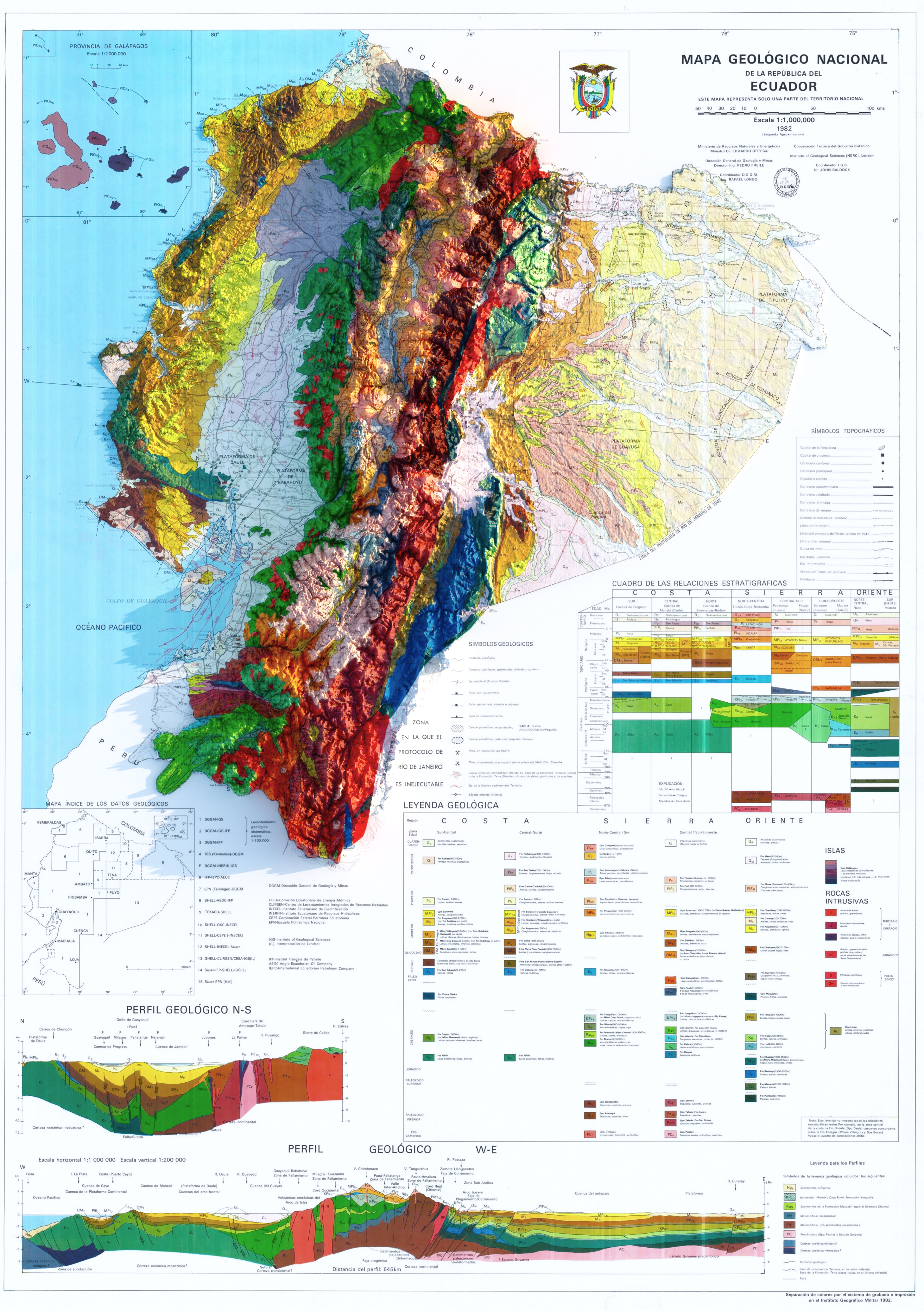
This project involves the enhancement of a 1982 geological map of Ecuador by incorporating SRTM 90 digital elevation data. The primary objective was to create a visually appealing 3D representation of the map using Blender. This process allowed for the transformation of a flat, historical map into a more engaging and dynamic 3D landscape.
The SRTM 90 data was utilized to provide the elevation details necessary for the 3D effect, while the original map added historical and visual context. The blend of these two elements was aimed at producing a visually interesting model that brings a new perspective to the old map, rather than conducting a geological analysis.
The result is a 3D visualization that enhances the aesthetic appeal of the original map, making it more accessible and interesting for visual exploration. This project demonstrates the potential of combining traditional maps with modern elevation data for creative visual presentations.
If you want to make your own, you can check Hemed's X profile.