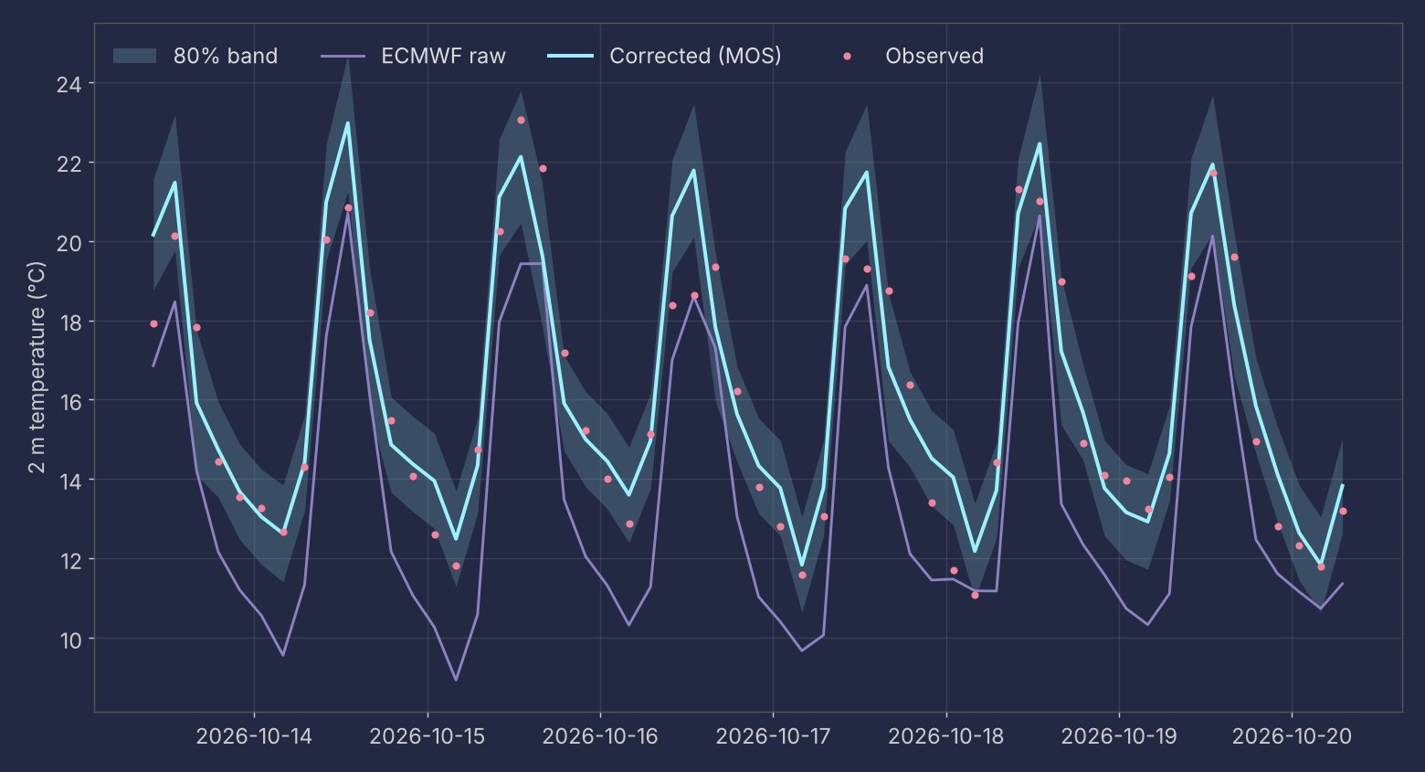
Forecasting and hydrology
Operational forecasts, river platforms and wildfire hazard
Operational forecasts, river platforms and wildfire hazard
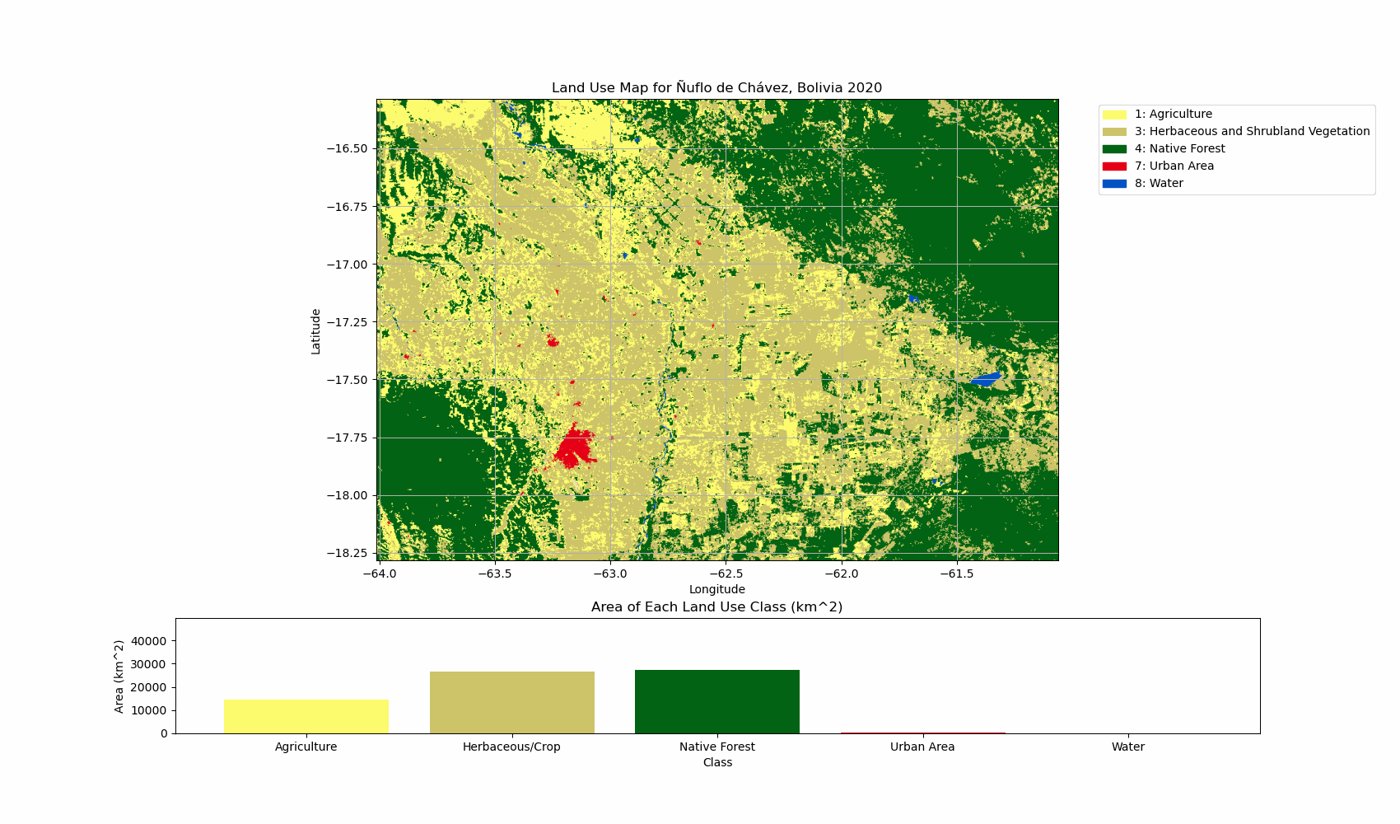
Projections, land cover and Earth observation

Dashboards, web apps and mobile apps

Step-by-step guides with working code
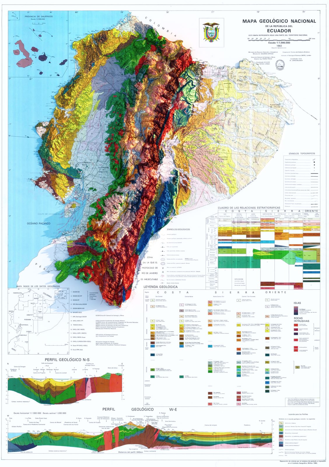
Historical maps rendered with Blender and QGIS
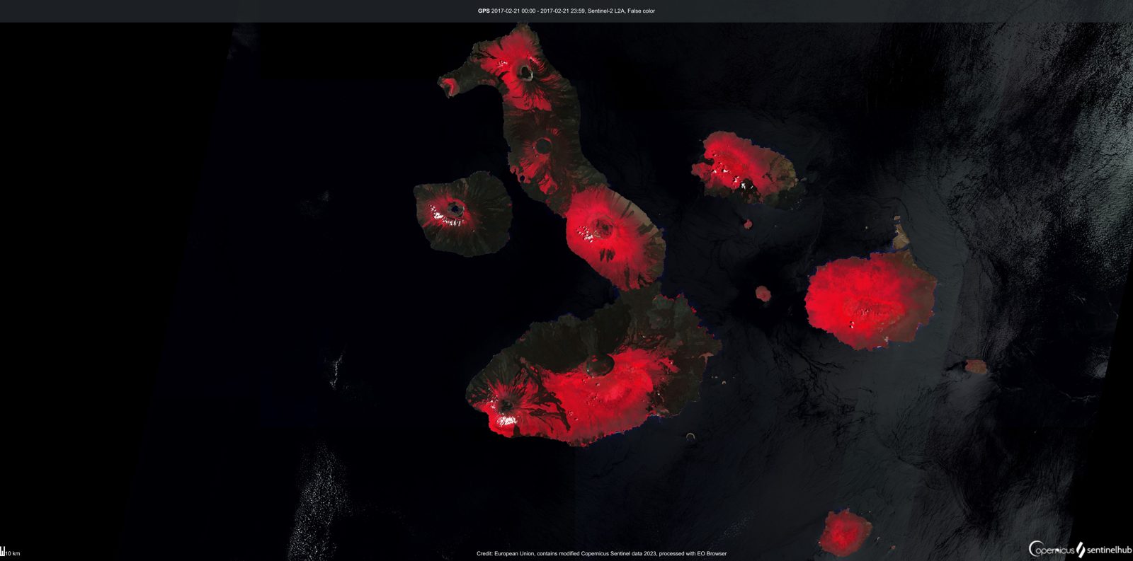
Image compositions from Earth observation data
I work on water and climate in the Andes and the Amazon. Most of my projects start with a practical question (how much will it rain, how will a river respond, where is fire more likely) and end as a tool that someone else uses every day.
Day to day that means Python for data pipelines and models, GIS and remote sensing for spatial analysis, and web development to put the results online: Django and Angular for institutional platforms, Dash and Streamlit for analysis apps, and GitHub Actions to keep forecasts running on a schedule. I care about verification, so the systems I build report how good they are against simple baselines.
I work as a consultant with research foundations, national hydrometeorological services and local governments in Ecuador.